
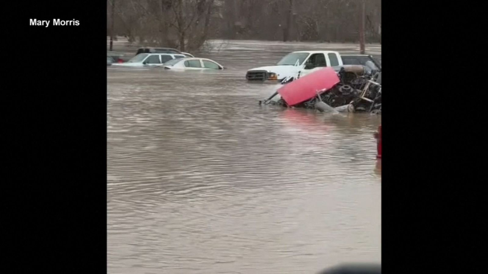
A powerful storm system tore across the eastern United States this weekend, unleashing severe flash flooding that has claimed at least eight lives in Kentucky alone. The catastrophic weather event brought a dangerous combination of torrential rain, damaging winds, snow, and ice to millions of Americans from the Deep South to New England, triggering emergency declarations, mass evacuations, and one of the largest weather alert activations in recent memory.
Eight Dead as Kentucky Bears the Brunt of the Storm
Kentucky emerged as the hardest-hit state as relentless rainfall overwhelmed infrastructure and waterways throughout Saturday and into Sunday morning. Governor Andy Beshear issued a state of emergency in advance of the heavy precipitation, warning that the entire state faced “significant threat from midnight to 4 a.m.” in a social media post on Saturday afternoon.
The death toll stood at eight as of early Sunday, with authorities continuing search and recovery efforts across multiple counties. Beshear moved quickly to request federal assistance, reaching out to President Donald Trump for an emergency disaster declaration that would unlock critical federal funds for the state response. The governor also coordinated directly with Homeland Security Secretary Kristi Noem and the acting director of FEMA to mobilize resources.
Widespread Flash Flood Warnings Across Multiple States
The National Weather Service issued numerous flash flood warnings throughout the weekend across a broad swath of the eastern United States. Kentucky, Tennessee, West Virginia, and North Carolina all faced active warnings as the storm system pushed eastward, placing more than 110 million Americans under alerts for dangerous flooding, destructive winds, and winter weather conditions.
Areas along the Kentucky-Tennessee border recorded the highest rainfall totals, with measurements ranging between four and seven inches. The sheer volume of water falling in such a compressed timeframe created conditions that local officials described as “alarming” and “extremely dangerous and life-threatening.”
Emergency Evacuations and Water Rescues
The human impact of the disaster became starkly apparent as emergency responders raced against rising waters to save lives. In Jackson, Kentucky, situated near Panbowl Lake about 85 miles southeast of Lexington, serious flooding forced the precautionary evacuation of both a nursing home and a hospital.
The Louisville Metro Police Department deployed its river patrol and diving teams alongside local fire departments, completing nearly 30 water rescues throughout the city. Authorities in Simpson County, Kentucky, also reported ongoing water rescue operations, with more expected as conditions deteriorated.
Across the state line in Tennessee, more than 50 residents of a nursing home in Macon County, approximately 65 miles northeast of Nashville, were evacuated to higher ground as floodwaters encroached on the facility. Macon County Emergency Medical Services coordinated the rapid relocation effort.
Joe Pitts, mayor of Clarksville, Tennessee, described scenes of “alarming flash flooding” in his city, where close to four inches of rain fell Saturday. With an additional two inches forecast through Sunday evening, the danger remained far from over.
Virginia and West Virginia Face Imminent Threats
The National Weather Service extended a flash flood emergency for several counties in West Virginia and southwestern Virginia until 8 a.m. Sunday, underscoring the persistent threat. In Richlands, Virginia, located in Tazewell County, local police urged immediate evacuation of residents in previously flooded areas.
“Multiple areas of the town are currently experiencing flooding, with the river expected to rise even higher,” the Richlands Police Department warned in a Saturday afternoon Facebook post. “Residents in previously flooded areas are strongly advised to evacuate at once. Evacuation should not be postponed.”
Virginia Lieutenant Governor Winsome Earle-Sears confirmed that National Guard airmen and soldiers had been deployed to support response operations. Her message to residents was unequivocal: “Don’t try to outrun a flood or anything. Get the higher ground if you need to.”
West Virginia Governor Patrick Morrisey declared a state of emergency spanning ten counties. Evacuations were actively underway in southern portions of the state, where the Bluestone River experienced major flooding near Spanishburg. Officials also warned that landslides and rockslides posed additional risks in areas saturated by the heavy rainfall.
Power Outages Affect Hundreds of Thousands
The storm’s impact extended far beyond flooding. More than 300,000 customers across Alabama, Kentucky, Mississippi, and Virginia lost electricity as the system knocked out power infrastructure. Georgia also saw significant outages, with more than 215,000 customers without power in the early hours of Sunday morning.
A severe thunderstorm warning issued for Atlanta at 4:30 a.m. Sunday brought wind gusts recorded at up to 71 mph at the city’s Mercedes-Benz Stadium, demonstrating the extraordinary intensity of the storm system as it pushed through the Southeast.
Winter Weather Compounds the Chaos in the Northeast
While the South battled floodwaters, the Northeast and Mid-Atlantic faced an entirely different but equally dangerous set of conditions. Snow began moving into the region Saturday afternoon, with conditions expected to worsen overnight.
The snowfall was forecast to transition to sleet and rain as the system progressed through the Northeast into Sunday, creating treacherous slushy conditions and hazardous travel conditions across major metropolitan areas. Cities like Hartford and Boston could see a slushy three to six inches before rain fell and compacted the snow, while parts of central and northern New England and northern New York State could see totals topping a foot.
High Wind Alerts Reach Unprecedented Scale
The sheer geographic scope of this storm system became apparent in the wind alerts covering more than 86 million people across 22 states for Sunday and Monday. The Northeast and Mid-Atlantic could see gusts reaching 60 mph through Sunday night, while the Southeast faced gusts up to 45 mph.
Meteorologists warned that damaging winds and flash flooding represented the primary threats, though the possibility of tornadoes could not be ruled out. The tornado risk extended into Sunday morning for parts of Georgia, with warnings potentially extending toward the Atlantic coastline as the storms continued their eastward march.
Looking Ahead: Recovery and Continued Vigilance
As cleanup and recovery efforts begin in the storm’s wake, residents across the affected regions are urged to remain vigilant. The combination of severe flash flooding, damaging winds, and winter weather has created a multi-faceted disaster that will require coordinated responses from local, state, and federal agencies.
Officials continue to stress that floodwaters should never be underestimated. The National Weather Service and local emergency management agencies are providing ongoing updates, and residents in affected areas should monitor official channels for the latest information. Those in previously flooded zones are strongly encouraged to heed evacuation orders without delay, as conditions can deteriorate rapidly with little warning.
This storm serves as a sobering reminder of nature’s capacity to disrupt lives across vast regions simultaneously. From the flood-ravaged communities of Kentucky to the snow-covered streets of New England, millions of Americans are confronting the aftermath of a weather event that demanded the full attention of emergency services and government leaders at every level.