
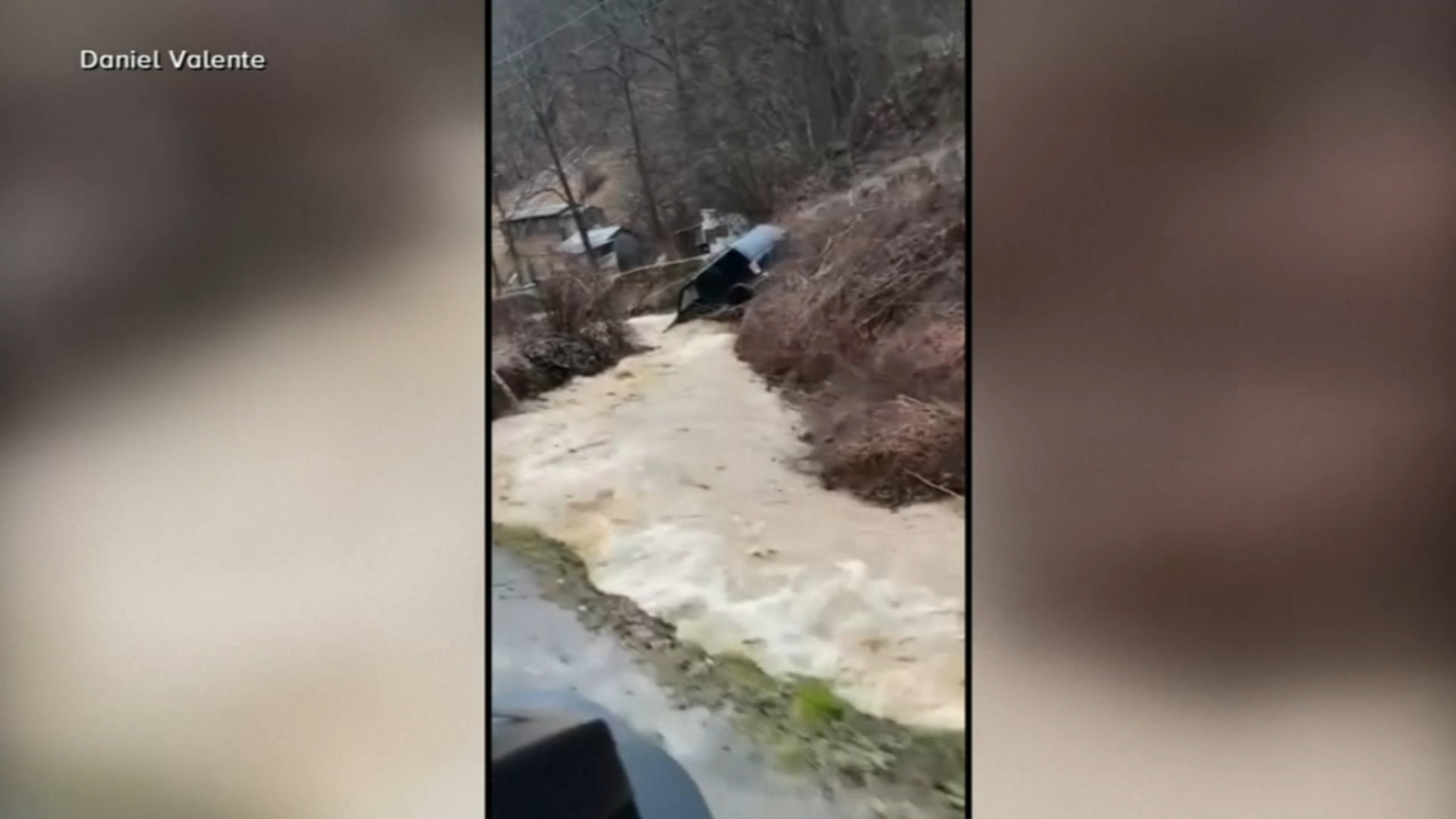
Kentucky flooding deaths have climbed to 12 as a weekend storm of historic proportions battered the Bluegrass State, leaving behind a trail of destruction, displacement, and heartbreak. Governor Andy Beshear took to social media Monday morning to warn residents that the crisis is far from over, emphasizing that dangerous conditions persist and urging people to stay off flooded roadways. With more than 1,000 rescues already conducted across Kentucky and another massive storm system bearing down on the region, communities are bracing for what could be an even more challenging week ahead.
The Devastating Storm That Claimed 12 Lives in Kentucky
The severe weather system that swept through Kentucky over the weekend proved to be one of the most dangerous weather events in recent memory for the state. At least 12 people lost their lives as relentless rainfall, hurricane-force wind gusts, and rapidly rising floodwaters created a perfect storm of deadly conditions. The flooding proved particularly catastrophic in low-lying neighborhoods, where flash floods trapped residents in homes and vehicles with little warning.
In Louisville, Mayor Craig Greenberg reported that emergency crews conducted more than 30 water rescues as the Ohio River and its tributaries swelled beyond their banks. The scale of the flash flooding Louisville experienced overwhelmed storm drains and created dangerous currents that even emergency responders found challenging to navigate. Neighborhoods that had never previously seen significant flooding found themselves submerged under several feet of water.
One additional storm-related fatality was reported in Georgia, bringing the broader death toll from this cross-country weather event to at least 13 people across multiple states. The widespread nature of the storm underscores how vulnerable large portions of the country remain to extreme weather events.
Rescue Operations and Community Response
The storm rescue efforts across Kentucky have been nothing short of heroic. More than 1,000 people were rescued from flooded areas throughout the state, according to Governor Beshear. These rescues involved first responders using boats, high-water vehicles, and even helicopters to extract stranded residents from rooftops, attics, and vehicles surrounded by rising water.
Local fire departments, the Kentucky National Guard, and emergency management agencies worked around the clock to save lives. Swift-water rescue teams were deployed to the hardest-hit areas, where they pulled families from flooded homes and transported them to safety. Shelters opened across the state to accommodate displaced residents, with the American Red Cross and numerous community organizations mobilizing to provide food, water, and temporary housing.
Governor Beshear praised the coordinated response while emphasizing that the danger has not passed. “Kentucky is still experiencing widespread impacts from the severe weather,” he wrote on social media. “We need everyone to be aware that conditions are dangerous, and folks need to stay off the roads in areas with high water.” His warnings highlight the ongoing threat of continued flooding even after the rain has stopped, as swollen rivers continue to rise and downstream areas face delayed flood crests.
Storm’s Widespread Impact Across Multiple States
The severe weather Kentucky experienced was part of a much larger weather pattern that affected states from the Deep South to the Northeast. The storm system dumped more than 8 inches of rain across portions of Kentucky and Tennessee, while Virginia received approximately 5 inches of precipitation. These rainfall totals, combined with already saturated ground conditions from previous weather events, created ideal conditions for catastrophic flooding.
Wind damage accompanied the heavy rainfall across a vast swath of the country. Wind gusts topped 70 mph in North Carolina, West Virginia, Maryland, and New Jersey, toppling trees, downing power lines, and causing structural damage to homes and businesses. The powerful winds extended into the Northeast, where they continued to cause problems through Monday night, complicating cleanup and recovery efforts.
In Northeast Philadelphia, a falling tree crushed a car and killed a woman during the dangerous winds, illustrating how far-reaching the storm’s deadly consequences extended. Power outages affected hundreds of thousands of customers across multiple states, with utility companies warning that some areas might remain in the dark for days as crews worked to repair damaged infrastructure.
A New Storm System Approaches
Even as Kentucky begins the long process of recovery, meteorologists are tracking another powerful cross-country storm system that promises to bring additional challenges. This new weather maker is already producing snow across the Cascades, Rockies, and into the Plains, and it’s forecast to sweep south and east through Wednesday.
The arrival of this next storm couldn’t come at a worse time for flood-ravaged communities. With many areas still dealing with standing water, damaged infrastructure, and displaced residents, the prospect of heavy snow and freezing temperatures adds another layer of complexity to an already difficult situation. Emergency management officials are urging residents to prepare now for the incoming weather.
Heavy snow is expected to blanket Kansas, southern Missouri, and northern Oklahoma beginning Tuesday morning. By Tuesday evening, significant snowfall will spread to northern Arkansas and southern Missouri, with travel expected to be severely impacted on interstates and highways throughout the region. Forecasters are predicting 6 to 12 inches of snow across these areas, with locally higher amounts possible in mountainous terrain.
Heavy Snow Forecast for Central and Eastern States
The winter storm forecast shows the system advancing further east by Wednesday morning, bringing snow to Kentucky, Tennessee, Virginia, and North Carolina. Nashville, Tennessee, could receive between 3 and 6 inches of snow, potentially causing significant disruptions to a city still recovering from recent severe weather. Virginia is also bracing for substantial snowfall, with Norfolk and Richmond each forecast to receive as much as 6 inches.
Washington, D.C., may escape the worst of the storm but could still see a couple of inches of snow, enough to snarl traffic and disrupt the federal government and school systems. Further north, cities throughout the Mid-Atlantic and Northeast are preparing for wintry precipitation that could create hazardous travel conditions.
For Kentucky, the combination of lingering floodwaters and incoming snow creates particularly dangerous conditions. Saturated ground may not be able to absorb additional precipitation, while snow on top of flood debris could complicate cleanup efforts. Residents are being urged to complete any necessary preparations by Tuesday evening, before the storm arrives.
Dangerous Cold Snap Grips the Nation
Perhaps even more concerning than the snow is the bitter cold weather alerts that have been issued across a vast swath of the country. More than 65 million Americans in 13 states stretching from Texas to Minnesota are now under some form of cold weather advisory, warning of dangerously low temperatures and life-threatening wind chills.
Numerous daily record low temperatures are expected to be set this week across the central United States, as an Arctic air mass plunges southward. Wind chills in North Dakota could reach an astonishing 60 degrees below zero, conditions at which frostbite can occur on exposed skin in just minutes. Such extreme cold poses serious risks to anyone who becomes stranded outdoors, as well as to those without adequate heating in their homes.
Major cities are preparing for brutally cold conditions. Minneapolis could experience wind chills as low as 42 degrees below zero on Monday and Tuesday nights. Kansas City is forecast to feel like 30 degrees below zero on Thursday morning, while Tulsa could experience wind chills of 17 degrees below zero on Wednesday and Thursday. Even Dallas, typically protected from extreme cold by its southern latitude, could feel like 10 degrees below zero.
Preparing for What’s Next
With Kentucky flooding deaths continuing to underscore the human toll of extreme weather, officials are emphasizing the importance of preparation and caution. Residents in affected areas should:
- Avoid driving through flooded roadways, remembering the adage “turn around, don’t drown”
- Keep emergency supplies on hand, including flashlights, batteries, non-perishable food, and bottled water
- Ensure heating systems are functioning properly before the deep cold arrives
- Check on elderly neighbors and family members who may be more vulnerable to cold temperatures
- Stay informed about local weather conditions and emergency orders
Utility companies are warning customers to prepare for potential power outages and to take steps to prevent frozen pipes, which can cause significant property damage and leave homes without running water.
Conclusion
The rising toll of Kentucky flooding deaths serves as a sobering reminder of nature’s destructive power and the importance of heeding weather warnings. As the state mourns those lost and begins the difficult work of recovery, another storm is already on the horizon, promising heavy snow and dangerously cold temperatures that will test communities still reeling from the weekend’s devastation. The coming days will require continued vigilance, cooperation, and compassion as Americans across more than a dozen states face unprecedented weather challenges. For those in affected regions, staying informed, staying prepared, and looking out for one another will be essential to weathering the storms still to come.